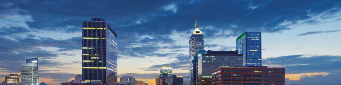
By now, I’m sure you have heard the news. Finally, the Cultural Trail is being extended. Yes, that magnificent, world-class bringer of investment. Over the last several years, the trail has seen over $1 billion worth of investment along its 8-mile path and, seemingly overnight, crafted Indianapolis into an urbanist mecca. A small trip to an adjacent metro like Cincinnati, Columbus, or Louisville reveals a huge insight: no one else around has this sort of thing. The CT has inspired visitors, catapulted real estate values, and brought connectivity to downtown neighborhoods, but moreso than all of that, on a philosophical level, it has provided genus loci, a spirit of place. It’s not just a f***ing bike lane.
And now, our wonderful Dutch-inspired cycle-track is growing up. In a big way.
The Indianapolis Cultural Trail, Inc. (a non-profit which always accepts donations, by the way), announced last Monday that a two-phase extension of the CT will take place over the next two years. The first leg, an Indiana Avenue cycle-track will connect from West Street in Ransom Place to the 10th and Indiana intersection before winding west to the hospital campuses of Eskenazi and Riley. This allows the segment to link with a future extension of the Fall Creek Greenway and the future connector to 16Tech. This is huge news for connectivity between major institutions downtown, including for students weaving between the growing IUPUI campus and the residential Canal District. Shameless plug, but I will smugly point out my prescience in predicting this last May:
“To the north, an obvious candidate for CT expansion is the Indiana Avenue district from 10th to 16Tech. Not only does the ROW probably exist, but the connection of downtown, IU Health, the IUPUI campus, and the state’s future largest tech incubator seems too good an opportunity to pass up.” (Read full article here)
The second extension is a short connector between the current CT spur off Capitol near Lucas Oil Stadium and the southeastern leg of the CT that slips through Fletcher Place. This future segment, atop of providing extraneous connection to the stadium, passes through the City Way neighborhood, the Irsay YMCA, and the Eli Lilly campus. It provides bicycle commuters in neighborhoods such as Bates-Hendricks and Fountain Square yet another alternative for getting downtown, and provides much-needed east-west connectivity. It should be also be well poised to provide connection to the proposed South Greenway, which would connect the CityWay development to Greenwood through the Old Southside and Garfield Park.
I asked this recently on Twitter, but, with this news, I could not help but wonder which cities in the United States have an amount of downtown protected cycling infrastructure comparable to Indy. The answer is, well, not many. And definitely not many among our peer cities. This is a time to celebrate Indianapolis and realize how far the city has come. As recently as ten years ago, none of this was here.
To celebrate this excellent news, I thought it proper to make a couple maps to illustrate the future network of protected infrastructure Indianapolis will have online in the next few years.
Current Conditions and Near-Term Expansion

Above, we see the existing Cultural Trail as it exists today (green). Important to note are the various spurs emanating from the Mile Square in form of protected bike infrastructure, namely the NY/Michigan pair and the recent Pennsylvania and Illinois lanes. However, the expansion news helps to bridge a couple of holes in this current set up, namely to the northwest and the south.

This updated map reflects the upgraded reach of the CT, and graphically represents how huge this expansion is. Not only will southern neighborhoods of downtown have more connectivity to the west side of the CBD, but the Fall Creek Greenway systems will now be fully integrated with the CT, allowing unimpeded movement between the future 16Tech district, IUPUI’s sprawling campus, Eskenazi/Riley, and downtown. This is huge!

Although the differences are harder to spot in the map above, there are some clear distinctions which have huge ramifications for connectivity in the Compact Zone. Namely, to the west, we see a spur of the B&O Trail headed off from Stringtown. Last May, I wrote about this:
I’ve talked recently on Twitter about the recent allocation of state funds for expansion of the B&O Trail from Speedway to Haughville funded by Governor Holcomb’s NextLevels program, which would extend the trail southeast toward downtown to Michigan St. My speculation was that, with further expansion along the abandoned B&O ROW, the Westside would potentially have its own version of Monon, connecting cultural facilities in White River State Park like the Indianapolis Zoo with Stringtown, Haughville, and Speedway.
In this map, we also see an extension of the Fall Creek Greenway system which will enable (almost) unhindered access from the White River to Fort Harrison once completed. Furthermore, included along with this map is the talked-about IU Health connector along Senate which is planned to shoot from the north arm of the CT and leg its way to the future Methodist campus at 16th. Keep in mind, these are all either funded (B&O, Fall Creek) or in the planning stages (IU), so they are definitely happening. This is the map of what downtown’s network will look like in the very near future.
Amazing how far this city has come, right?
Now, let’s have some fun.
What if?

In this scenario, the city has found funding to really go for it in terms of creating bike infrastructure. In this proposal, I favored connections that were already outlined by the city in previous transportation planning efforts (as found on Plan Indy) and ones I considered more feasible than others. That being said, my ideas are still a bit unrefined. Feel free to let me know in the comments.
Proposed Cycle-Tracks and Shared Streets
I propose extending cycle tracks in all directions from the CT: Michigan/NY to the west, Delaware to the north from Mass, Market from Alabama to Highland, and on College from Mass to Virginia. This cycle-track network, along with the CT would surely give Indianapolis an advantage in any conversation on bicycle infrastructure in the U.S. The Mich/NY spurs would create connectivity to maligned Haughville and the resurgent Stringtown (which is NOT River West) and along with the planned B&O Greenway would provide uninterrupted access from the west side to educational facilities downtown.
I have been a huge proponent of Delaware getting a road diet for the longest time. I have written about this on here and also on the City:One challenge Ford hosted last year. The street is a four-five lane behemoth from Mass to the interstate and then a three lane racetrack through the Old Northside where children and families live. It makes sense to take away just one of those lanes for a protected cycle-track. This spur finally gives Herron-Morton and Old Northside residents a bit of access to downtown without risking their lives getting to the Penn or Illinois bike lanes. With Mayor Hogsett’s Neighborway plan, a multi-modal corridor along Delaware would act as a spine. Without protected infrastructure, commutes from the dense neighborhoods between the interstate and Fall Creek will remain a hindrance for all those east of Meridian. Sharrows will not be enough.
The Market Street cycle-track is a fun one to ponder. Highland Park and the Near-Eastside have been rebounding for a while now, but with the advent of Bill Oesterle’s Elevator Hill redevelopment of the former Angie’s List campus, a unique opportunity exists to connect these areas to the Mile Square. I propose taking away a lane of parking on Market between Alabama and College, and then a shared multi-modal street between College and Dill (to allow movement of police vehicles from the jail facilities), with a reversion back to a two-lane road with a cycle-track east of Dill all the way to Highland. Right in the backyard of Oesterle’s development, this infrastructure could provide the Near-Eastside a prime connection into the heart of the city, and further ripen redevelopment efforts in the area. With the emergence of the future Blue Line, this could augment efforts to drive development down Washington St. A spur (either shared-street or protected lane) would then connect the Market St. segment with Highland Park and its best views of downtown.
For my final cycle-track proposal, I suggest the corridor of College from just south of Mass Ave to Virginia Ave in Fletcher Park. Many in the city have been clamoring for a College connection for the longest time, and frankly, this segment just makes sense. Connecting the city’s two (arguably) most popular neighborhoods would make north-south commuting much, much easier. Most of this can be achieved through taking a lane of parking away from College, although some funkiness occurs around the Washington St. aqueduct. Especially with the arrival of the Bottleworks District this year, creating passages for pedestrian and bicycle traffic between southern and northern downtown neighborhoods will be crucial. Granted, with enough political will, this segment could get done.


Proposed Protected Bike Lanes
Atop of all those cycle-tracks, Indianapolis could cement its north-south connectivity with a protected bike lane on East from Michigan south to Bates-Hendricks, and establish more neighborly connection between Fountain Square and Bates-Hendricks on Morris from East to Prospect.
I also include a spur from the Michigan protected lane near Arsenal High along Oriental, allowing a connection with Pogue’s Run and the Cultural Trail at 10th. This would complete connections to all Near-Eastside neighborhoods (Highland Park, Woodruff Place, Cottage Home, Holy Cross, Elevator Hill) to and from the CT.
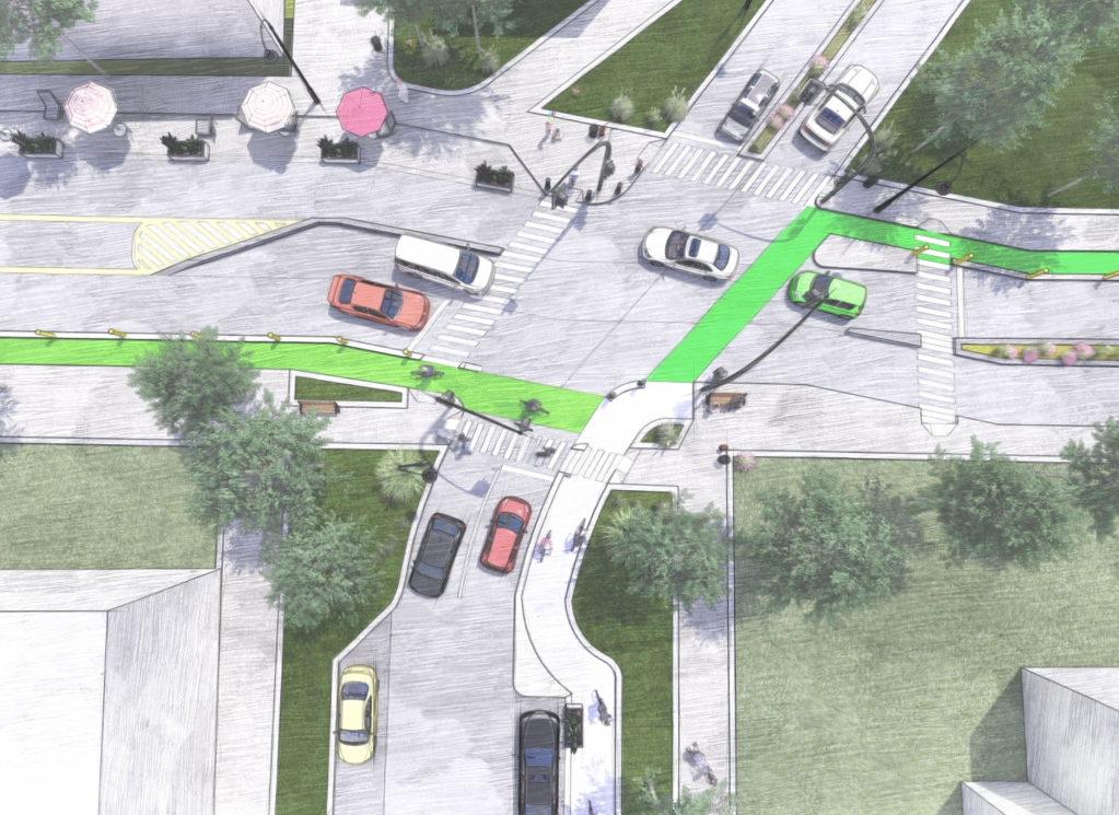
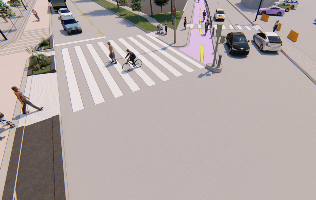
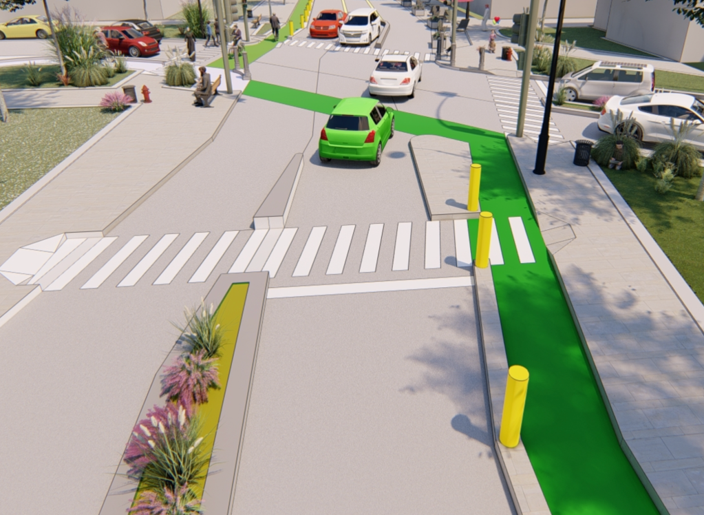
The most important proposed bike lane, in my opinion, is a run of protected infrastructure along 16th from Senate to the Monon. 16th currently is a monstrous, scary place to walk, and with a burgeoning population, a popular high school, and rapid development, the city owes it to Near-Northside residents to do the right thing and put in a protected bike lane. Although I put these renderings on Twitter awhile ago, feel free to look again at what a re-envisaged 16th corridor looks like.

I truly believe that Indianapolis is trending in the right direction. No other city of its size in the U.S. has anything commensurately close to the Cultural Trail. While my “what-if” scenario is all in good fun, I truly do believe that if some of these changes are put forward to augment and piggyback off the CT, Indy could very well become the best city for bicycling in the country.
A network hierarchy of cycle-tracks and protected lanes would solidify connections between neighborhoods and cement mobility options such as Indianapolis’ young BRT network. Investing in a radical (but not so radical) downtown cycle-track network could rebrand Indy as a bicycle capital in the vein of Portland or Minneapolis. Such an investment would encourage increased density in the Mile Square and, more importantly, increase the viability of real estate projects with little or no parking getting funded. Providing parking is a huge burden upon developers but often times, banks will not provide debt financing if it is not included. If a market such as downtown Indianapolis becomes increasingly reliant upon the bicycle as a form of transport, those banks may rethink their decision. As the country and the city will want to mitigate the catastrophic effects of anthropogenic climate change, encouraging bicycling will be more important than ever. So, let’s do it.
Anyway, if you’ve read this far, I’m guessing you appreciate my work and writing. That being said, I am currently seeking work in the urban planning and real estate development fields. Give me an email through the site or reach me at ( tompkinsjeffery@gmail.com ).
Thank you for reading and thanks for loving Indy. Onwards.
*All renderings by Jeffery Tompkins
